Mt. Longonot Hiking Guide
I have always wanted to hike Mt. Longonot for as long as I can remember. At around 14, I had the chance to climb it but I happened to be in the company of uninterested people. We only went to the small town centre at the base of the mountain, Longonot. It wasn’t an ideal day either because we were supposed to head back to grandma’s place, which was a far way off. After that experience, I vowed to go back regardless of whether I would be alone or with a group of hikers.
At the end of February this year, I decided I was going to hike at the earliest chance possible. My initial plan was to go there on a weekend because there would be more people and I wouldn’t have to worry about going off track. I felt anxious pretty much the entire week and couldn’t wait for the weekend. On Friday, 3rd March, I attended a meeting which I expected would end early. I also happened to have a job, which I concluded I would be doing in the evening. However, by the time I got to my house in the evening, it was quite late and I was feeling particularly tired. I couldn’t even open my laptop and decided to do it in the morning. Due to exhaustion and poor sleep all week, I woke up late the following Saturday. It would have been impossible to finish the job and head out because hikes often require someone to head out early, especially when using a new route to get there. I worked in the afternoon and made plans to wake up early on Sunday and head out. As fate would have it, I woke up late in the morning. Sunday's are often slow and quite hectic when using public transport. Most of the routes take too long to get enough passengers. Anyway, I pretty much gave up on going anywhere.
By the end of the day, I had made up my mind that I would be doing the hike on Monday. I figured there was no point in waiting for the weekend considering that I have an unpredictable work schedule. I took a shower at around midnight and had a couple hours of sleep. I was up by six thirty in the morning and had an easy time packing all that I needed for the day. There wasn’t much except two bottles of water, cookies, fruits, a cap, and sunscreen. The bus that I boarded chose a much longer route even though there wasn’t much traffic. I arrived in town at around 8.15 and boarded another bus that would drop me off at the base of the mountain. The journey was uneventful except for a car that veered off the road and epically crashed upside down in a ditch while trying to overtake on a steep hill. The passengers were lucky to have only escaped with no physical injuries as the ditch stopped them rolling over on the cascading rift valley escarpment.
I arrived at the town centre at 11.40 a.m, quite late, and began walking towards the entry gate.
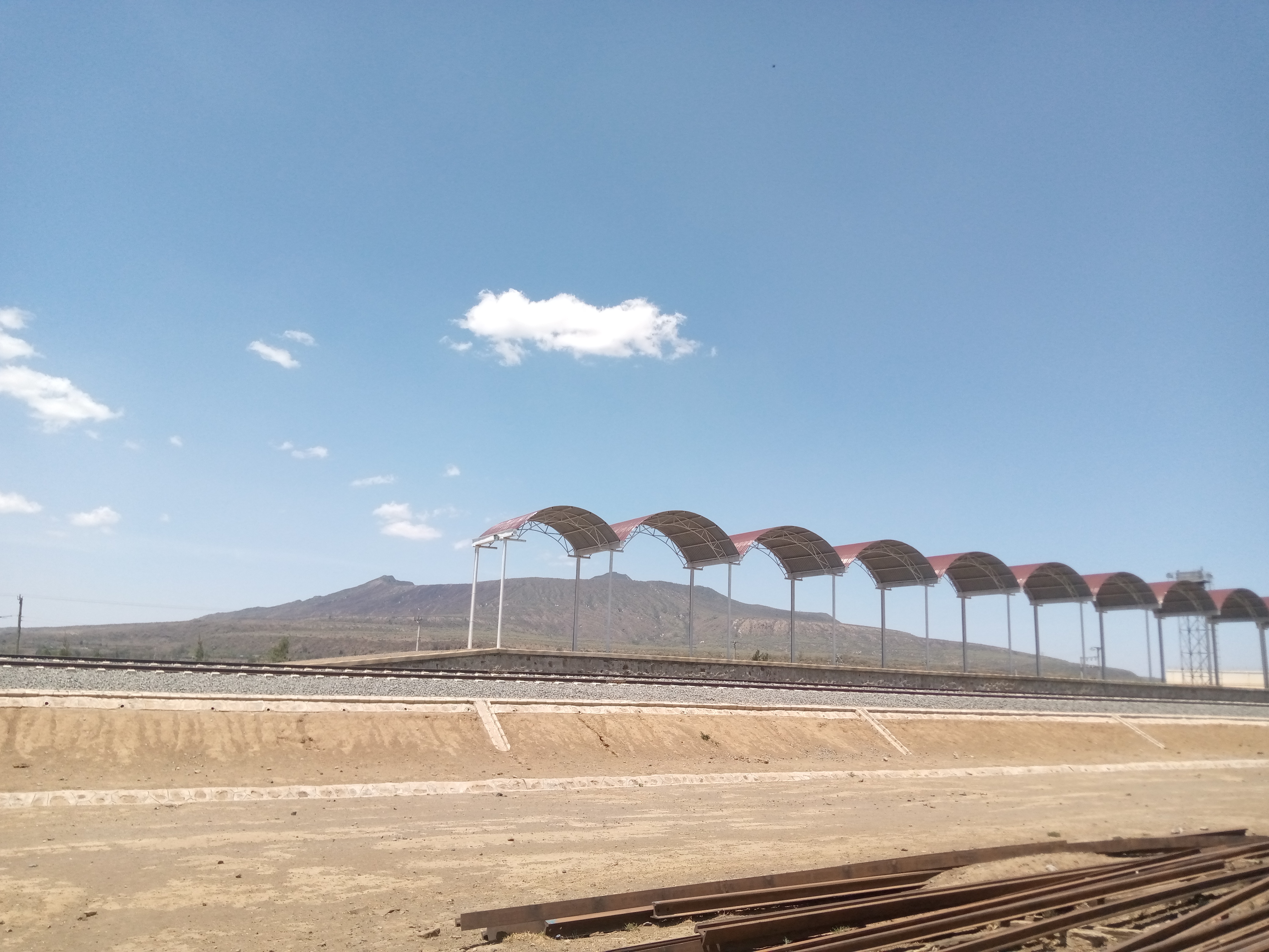
First stop across the road - Naivasha railway line.
The gate was a far way off. It took about thirty five minutes to get to on foot. I asked for directions from a passenger who also got off at the same point and set off. There were very few people at the entrance gate, mostly Mt. Longonot National Park staff. I paid the entrance fee through m-pesa, as is expected in almost every institution managed by the government. During the ascent, I only bumped into two hikers who were climbing down. The track was obviously marked, probably due to the high traffic of hikers. Some diversion paths were also covered with acacia branches to warn hikers that they would lead them in the wrong direction. The climb up was pretty routine with only a few extremely steep sections. I stopped to catch my breath every few minutes in those sections and managed to get to the crater rim in under an hour. The view from the crater rim is absolutely stunning!
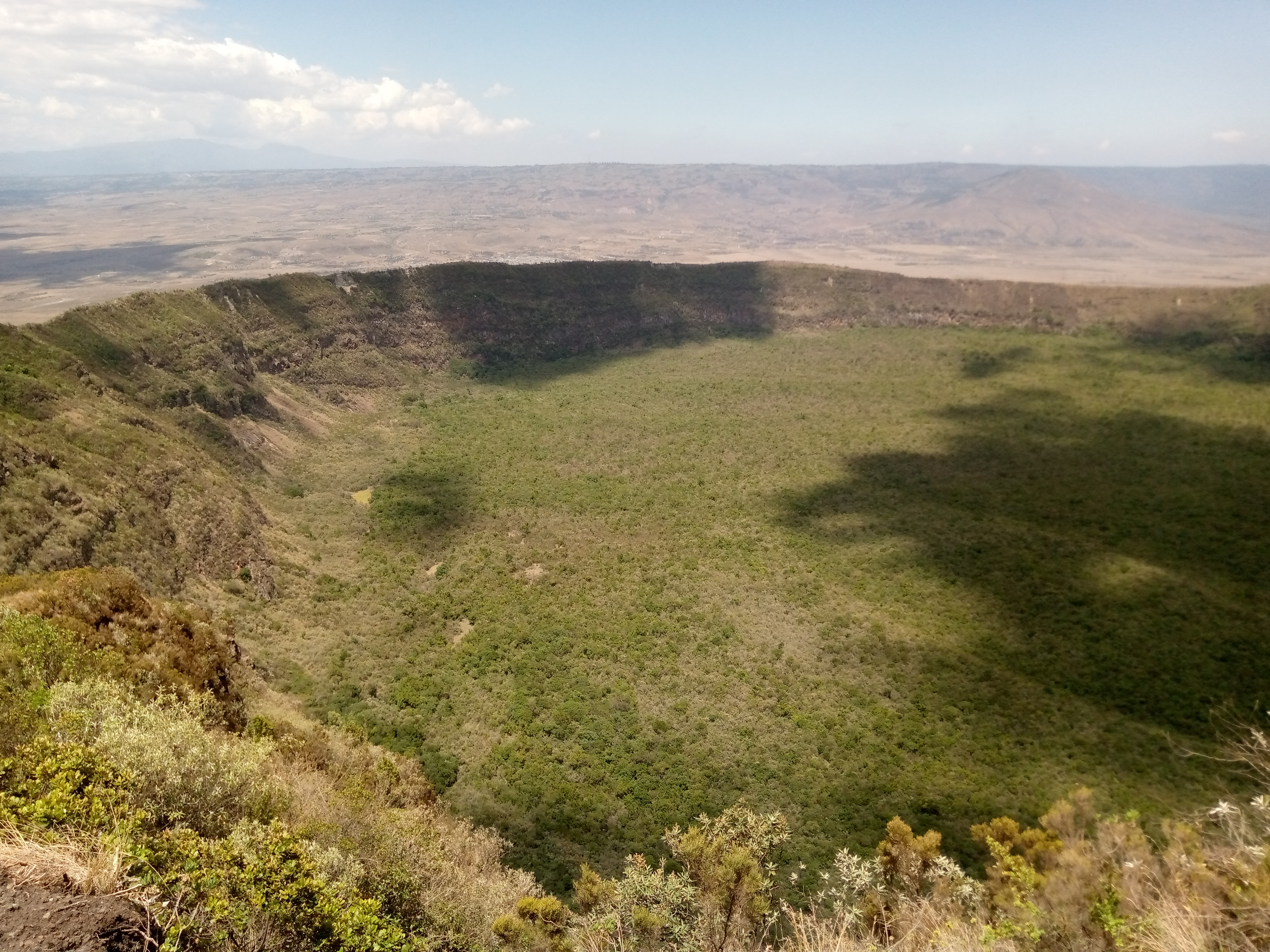
Shot taken at the Crater Point.Altitude 2560m.
The picture above does not do the view justice. The crater looks vast and is surrounded by green vegetation from the top to the bottom of the escarpments. There are no tracks leading to its bottom probably due to the steep elevation of the crater walls.
After resting for a few minutes, I set off on the path used to go around the crater. The total distance around is 7.2 km. My initial plan was to walk as far as I could while making sure that I had enough time to descend and catch a ride back home. Most of the path in the initial section was flat and relatively easy to walk on compared to the ascent. Some sections had gravel that slowed me as I had to constantly try to maintain balance without a hiking stick. After walking for about 45 minutes, I sat for a while and contemplated descending. I felt it was late and knew that I could not circle the entire crater. I opened google maps to check how much further I distance I needed to cover to get to the other side. With luck, I saw that I was only about 850 metres away from the summit and that it would take about 13 minutes to get there. I felt motivated to set off again on the particularly steep ascent. Little did I know that it was going to take much longer than I expected. Clearly, google maps did not account for the elevation when allocating the time. The steep stretch took close to half an hour but I got to the summit eventually. From that vantage point you can see the entire crater more clearly, and see the entire surroundings of the mountain.
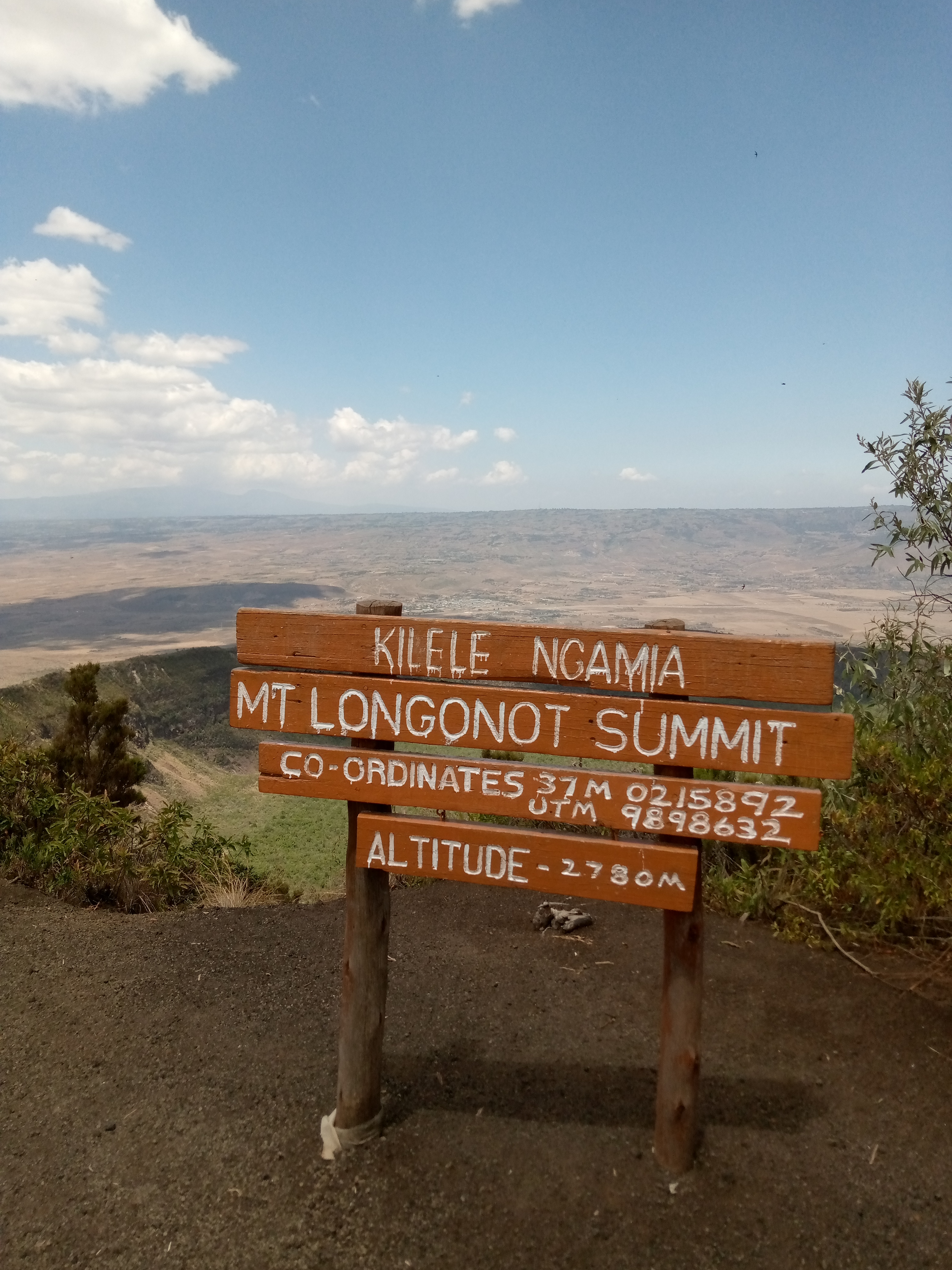
Mt. Longonot Summit
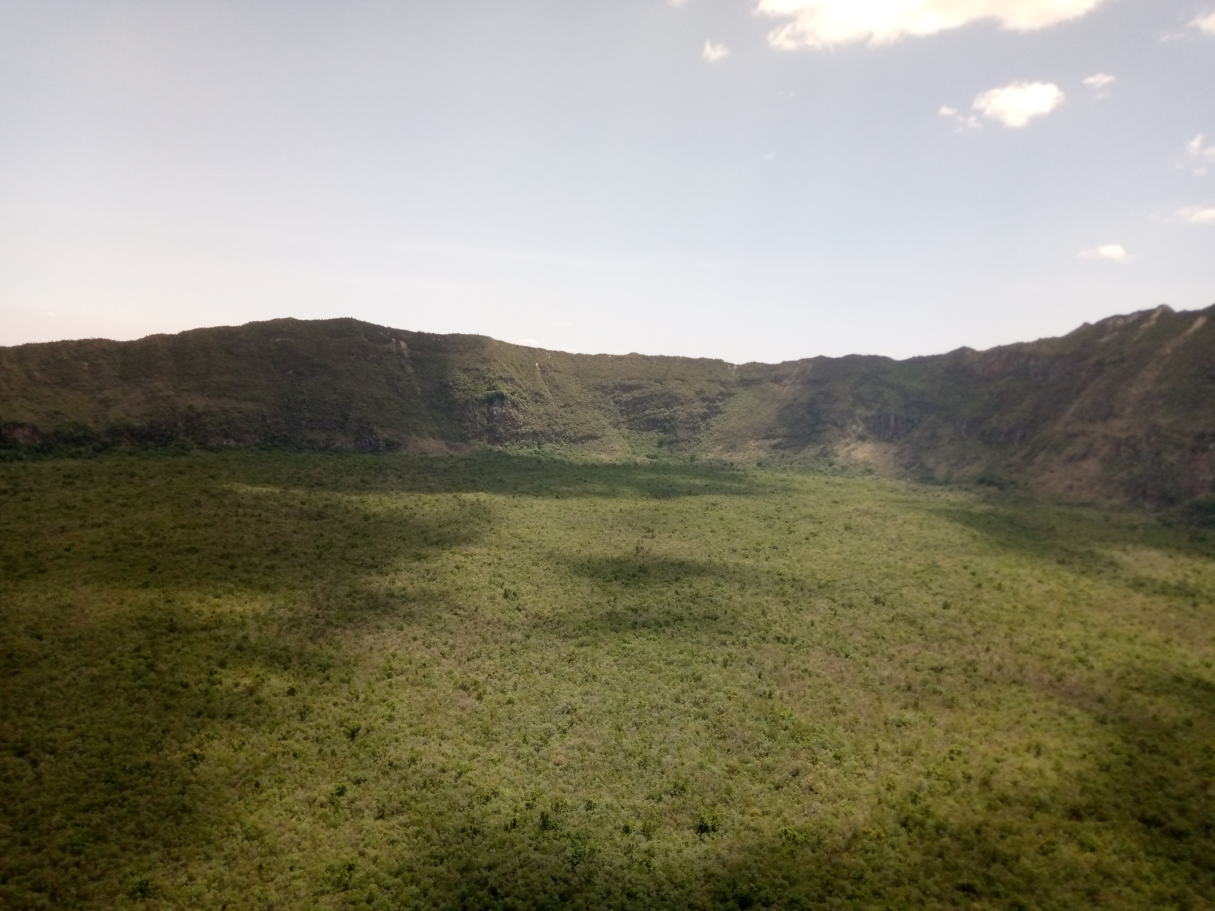
A bird's eye view of the crater from the summit.
The descent was much more fun because I mostly ran downhill. It was just easier to let go and let gravity take over. I didn’t have to worry about falling down either because there were multiple turns that slowed me down. Out of sheer luck, I managed to hitch a ride all the way back to Nairobi, and was dropped a short way from where I lived. Overall, it was an exciting adventure that I would totally be open to experiencing again. Next time,I will make sure I carry my pro camera and ensure that my phone is fully charged.